Lubeck Maps and Orientation
(Lubeck, Schleswig-Holstein, Germany)
A city located in northern Germany and in close proximity to
Hamburg, Lubeck lies next to the coastline and is home to a population exceeding 200,000 people. One of the biggest cities within the German state of Schleswig-Holstein, Lubeck is famous for its striking brick Gothic-style buildings and architecture, and is know listed as a World Heritage Site.
The city of Lubeck stands next to the Trave River and is home to the biggest harbour in the whole of Germany, standing alongside the Baltic Sea. For a true taste of days gone by, the old town Altstadt area is sited on an island and encircled by the meandering Trave River, with both the Hauptbahnhof railway station and also the main bus station standing nearby and to the west.
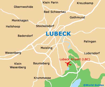
Maps and Orientation of the City
Lubeck is easy to find your way around, since much of the signposting is also written in English, as well as German. Some of the city's churches and main attractions also feature multi-language electronic information points.
However, to make sure that you don't get lost, particularly if you choose to drive outside of Lubeck, be sure to bring a good map or purchase one at the local tourist information centre (Lubeck Travemünde Tourismus), which can be found along Breite Strasse. The following locations are particularly close to Lubeck and may be of interest when travelling outside of the city boundaries.
- Ahrensburg - 46 km / 29 miles (45 minutes, south-west)
- Bad Schwartau - 8 km / 5 miles (10 minutes, north)
- Hamburg - 64 km / 40 miles (one hour, south-west)
- Klein Molzahn - 34 km / 21 miles (35 minutes, south-east)
- Neutechau - 14 km / 9 miles (15 minutes, north)
- Ratekau - 13 km / 8 miles (15 minutes, north)
- Ratzeburg - 30 km / 19 miles (30 minutes, south)
- Sankt Jürgen - 3 km / 2 miles (6 minutes, south)
- Schlutup - 10 km / 6 miles (12 minutes, east)
- Stockelsdorf - 5 km / 3 miles (7 minutes, north-west)
- Süsel - 32 km / 20 miles (35 minutes, north)
- Tankenhagen - 27 km / 17 miles (30 minutes, east)
Map of Germany

Map of Lubeck